Sunday, January 13, 2013

World's longest cable hanger in Vietnam

Vinpearl Land Cable Hanger is over Nha Trang sea, connecting Nha Trang with Hon Ngoc Viet tourism area on Hon Tre island. This is the world's longest Hanger and it can contain the most people in one cabin.

The construction started in August 2006. After more than 14 months of building, the Hanger Cable was put into operation on March 10, 2007. On every viewing corner of Nha Trang city, the tourists can see a system of cable hanger with 9 cable pillars having the shape of Eiffel tower in France. 

The Cable Hanger is 3,320 meters long with 9 pillars, the highest of which is 54.65 meters, the shortest is 7.96 meters. Its total weight is up to 7000 tons. However such equipments like gas station, cabins..imported from France are counted for one fourth of the total 200 billion dongs ($10 million). It is nearly considered absolutely safe.
Vinpearl Land

The cable hanger is designed to have 65 cabins, serving 1500 tourists per turn every hour. Each cabin will run through the route between Nha Trang and Hon Tre island for nearly 9 minutes 20 seconds. The hanger can withstand the level 7 wind, the maximum compensation cost for an accident on one cabin is 12 billion dongs ($600.000).
Vinpearl land

Seating on the Vinpearl Cable Hanger at the height of 54 meters, the tourists can view thoroughly the marine city and Nha Trang Bay, one of the world's most beautiful bays under a strange view. This Cable Hanger took the interest of a lot of people while being under construction. Based on the length, the Cable Hanger is considered to be the longest in the world and is able to receive Guiness world record. For this reason, Discovery Channel sent one responsible team to record first images of his Hanger.  

Vinpearl

In addition to the stretching wonderful beach, recreational areas that the nature gifts, the Cable Hanger Vinpearl Land adds one more reason for the local as well as foreign tourists to choose Nha trang as their destination.
Love Waterfall in Sa Pa

Sa Pa is not only well known for the charm of being a misty mountain town with terraced rice fields stretching continuously on the mountains, but also for its romantic waterfall called Love.
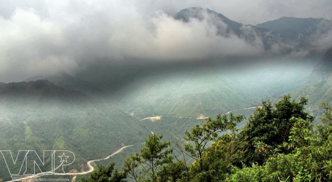
Love Waterfall, located about 4km to the North-West of Sa Pa Town in San Sa Ho Commune, Sa Pa District, Lao Cai Province, is a “must-see” destination on the Sa Pa tour. Driving on a red soil road to the waterfalls that winds through a primeval forest of lush ancient ivory trees and rhododendron flowers in white, red and yellow colour, tourists have a chance to enjoy a perfect painting-like landscape.
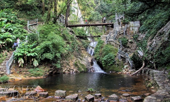
  The beautiful scenery at the foot of Love Waterfall.

From afar, the waterfall looks like a twinkling pyramid under the sun. It has a height of about 100m, and starts from the peak of Fansipan Mountain and rush noisily into the Gold Stream like a never-ending song. Under the waterfall, the Gold Stream runs along with green grass plots and bamboo clusters, forming a poetic image.
Love Waterfall is part of the tour to the imposing mountain range of  Hoang Lien Son.

According to the local people, the name of the waterfall originates from a love story. Legend has it that long ago, fairies from heaven used to come to the waterfall to bathe. One day, the seventh fairy saw O Qui Ho, the first son of Ai Lao Mountain Genie who was playing his flute near the falls.
The Waterfall is a popular destination in Sa Pa.

Mesmerized by the flute sounds, the fairy spent every night listening to the sweet melodies until her parents detected her secret and forbade her from coming to the human world.The fairy missed O Qui Ho so much that she spent every afternoon at heaven’s gate looking towards the waterfall and waiting for the sounds of the flute. Then, she transformed herself into a yellow bird that lives on O Qui Ho Mountain. Since then, the waterfall is called “Love” to remind everyone of the legendary love story.
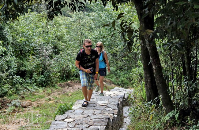
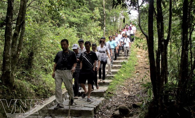
On the way to Love Waterfall, tourists discover the beauty of a primitive forest. 

Currently, the Netherlands Development Organization (SNV) has suggested listing Love Waterfall in the “West-North Route” tour as it has a promising potential to become one of the most attractive destinations in the mountainous district of North Vietnam.

Beautiful scenery on Ly Son Island


Only a few people know that Ly Son Island in Quang Ngai Province in Central Vietnam was d from five extinct volcanoes during the prehistoric age. With wonderful scenery left by these volcanoes, the island has now become an alluring destination, attracting a large number of tourists.
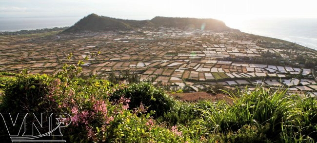
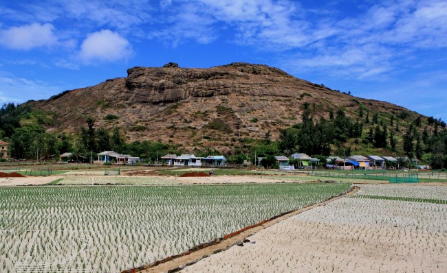
Seen from the shore on a fine day, Ly Son Island looks like a pyramid on the sea with its top being the peak of Thoi Loi Mountain. Among five mountains founding on the island, Thoi Loi is a rocky one. After a long time climbing the tortuous path on the mountain, tourists reach the peak of Thoi Loi where they have a panoramic view of the garlic field that looks like a chess-board and an immense blue sea dotted with fishing boats in the distance.


A panoramic view of Gieng Tien Mountain from the peak of Thoi Loi Mountain. Photo: Viet Cuong

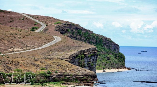
The road to the peak of Thoi Loi Mountain. Photo: Thong Thien

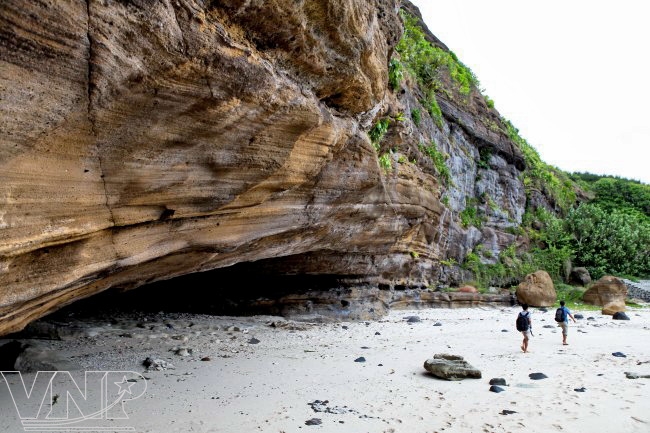
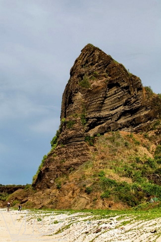
At the foot of Thoi Loi Mountain. Photo: Viet Cuong.

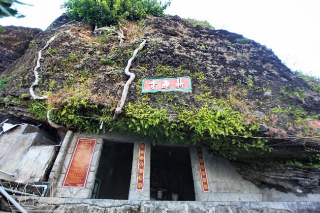
Duc Pagoda is located halfway up Gieng Tien Mountain. Photo: Thong Thien

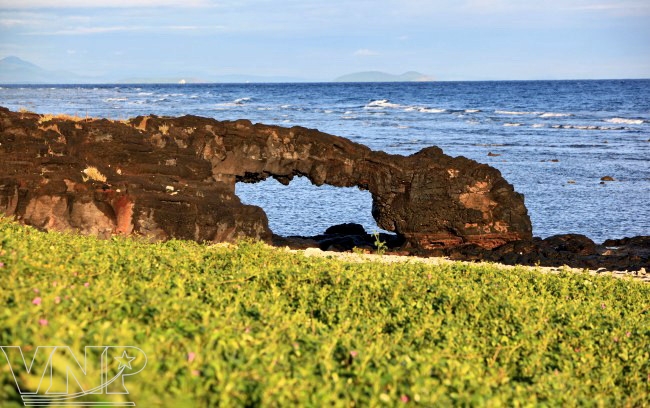
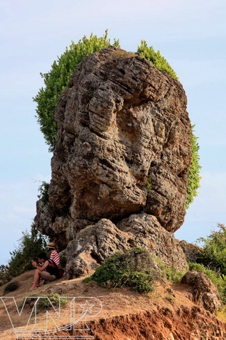
The cold lava from the exinct volcanoes millions of years ago forms a beautiful scenery. Photo: Viet Cuong

A garlic field at the foot of the mountain.

The rain-water reservoir built on an area which was formerly a primitive forest. Photo: Viet Cuong

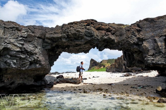
"The Heaven Gate" was formed by the cold lava from the exinct volcanoes millions of years ago. Photo: Viet Cuong

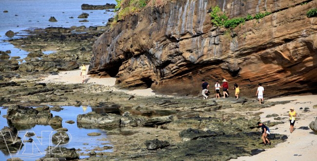
Beautiful cliffs near Hang Pagoda on Ly Son Island. Photo: Thong Thien
According to the old people in Ly Son, the hollow of the extinct Thoi Son Volcano was formerly a primitive forest of different valuable trees and had abundant fresh water resources which ran at the foot of the mountain to form Chinh Stream. Then, the forest was totally destroyed and the stream no longer exists. So far, there is only a relic left – Hang (Cave) Pagoda. Due to the sea’s impact on geology for hundreds of years, the layers of rock have been eroded and have formed a cave in the shape of a pagoda.

Unlike Thoi Loi Mountain that has only rocks, Gieng Tien Mountain has a special fertile soil, similar to the Bazan soil in Tay Nguyen (the Central Highlands). The locals often use this soil and sand to fertilize the garlic fields. Thanks to these fertilizers, the variety of garlic grown in Ly Son has a special flavour that is hardly known in other places.

 Around the crater of Gieng Tien Mountain that is smaller than that of Thoi Loi Mountain is a piece of land where no plants can grow. According to the beliefs of the locals, it is the sacred oil that was used as ash on the graves of soldiers of Kiem Quan Bac Hai Squad who laid down their lives when protecting the Hoang Sa (Paracel) Islands during the reign of King Minh Mang (1791-1841).

The remaining part of Gieng Tien Volcano.

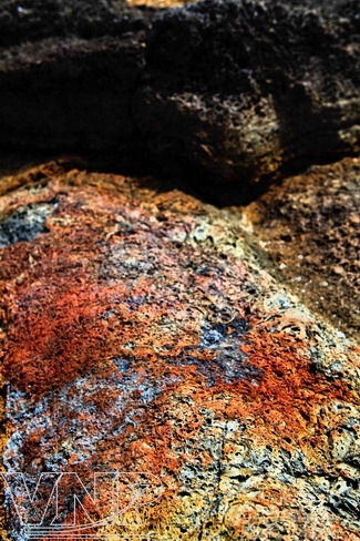
  A colorful stone on the mountain.

At the peak of Thoi Loi Mountain .

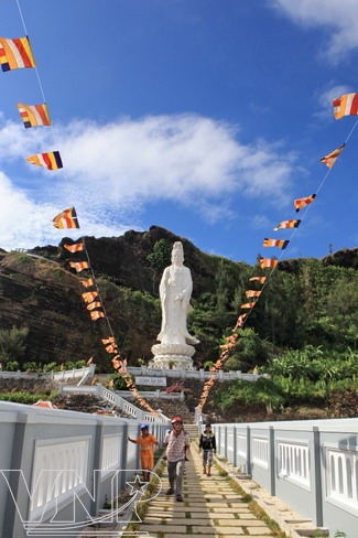
The way to Duc Pagoda.

To the east of Gieng Tien Mountain is a strange pagoda, called Duc by locals. Visiting the pagoda, tourists learn a story about the Goddess of Mercy who traveled on Bac Hai Sea to save fishermen in distress. Seeing fishing boats being sunk by storms, she tore her robe into thousands of pieces and threw them into the sea.

These pieces of cloth turned into dolphins which saved fishermen on the sea. Due to their belief, the locals made a statue of the Goddess of Mercy, 27m high, facing the sea and placed it at the pagoda with the hope that the Goddess of Mercy will protect fishermen when they go to the sea.

Although the relic of three extinct volcanoes is only small mounds, the presence of cold lava is seen in many places on Ly Son Island, forming a wonderful landscape. They are rocks in different shapes that leave a long-lasting impression on tourists to the island.