Wednesday, October 31, 2012

Landscapes of Dalat highlands

Dalat, a highland city about 257 km in from the coast, reminded us of Toowoomba. It has the cooler temperatures and the red rich soil that has made the area a huge production area for coffee, vegetables and flowers.

This town was also at one time the town where the French escaped the sweltering summer months along the coast to enjoy the cooler highland air. As a result it has many beautiful homes and hotels.

In the Dalat highlands

On a long walk around the town we saw a number of the 2500 lovely houses the town is famous for. It is quite amazing the place developed so much as even now the road we took in the bus from the coast is a very narrow winding road in fairly poor condition.

Dr Alexander Yersin, a protégé of Louis Pasteur apparently spread the word to Europeans about the liveability of the town in the summer months. The town was also spared damage in the Vietnam War as officials of both sides were still using their villas here for relaxation. Emperor Bao Dai’s Summer Palace is in a pine forest here and is not far from the tacky ‘Crazy House’ a guest house designed by a Vietnamese woman from Hanoi who did her architecture degree in Russia.

The building is like a tree, and rooms are decorated in various styles eg the Bear Room has a large bear with glowing eyes. Not the best place to sleep, especially as you would have to be up and out early before the paying sightseers arrive…

In the Dalat highlands

The coffee farm was first. I didn’t know that Vietnam is the world’s second largest producer of coffee, Brazil produces the most and Columbia comes after Vietnam. The French started the plantations. We were shown three types of coffee plants – the older type ‘cherry’ trees, which are tall and not handy for picking etc, and then ‘Robusta’ and Arabica’. They didn’t tell us so but I read that currently they mostly grow Robusta beans which are not as good a quality as the Arabica, so they are starting to change over.

In the Dalat highlands

Last stop was Elephant Falls. Our guide told us a tale of a prince and princess who wanted to marry but were from different ethnic group. As marriage was impossible (this is the Romeo and Juliet story) they killed themselves. The elephants living here heard the story and their tears made the waterfall. We had to walk/climb down a precarious track of steps and rocks with rusted out railings at a few points.

We made it up and back but a bit scary. Occupational health and safety not very developed here. It was however much better than the falls we visited in town. Cam Ly Falls turned out to be a polluted canal type stream that flowed through a small amusement type park. We did see our first ‘horses painted as zebras ‘here however so that was a new experience.

Soon it is our last night in Dalat. For dinner we had a Beef Hotpot where a pot of stock was put over a little burner on the table, and we gradually added and then ate the thin beef slices, green vegetables, herbs and noodles. No complaining about the food in Dalat.
Jannettek (From Australia)

Da Mi Lake – Beauty of princess sleeping in forest

Coming to Da Mi Lake, tourists can contemplate both the romantic and poetic sences and the peaceful space.

Located in Ham Thuan Bac of Binh Thuan province, Da Mi town is known as the land of romantic and poetic scenes that is similar to the landscapes of Da Lat highland.  And one of those most attractive destinations of Da Mi town that any tourist coming here even once also has unforgettable memories is Da Mi Lake.


Nestled in the immense forest of Da Mi, Da Mi Lake is considered as the princess sleeping in the tranquil and peaceful space. Indeed, in the mild sunshine together with cool climate here, maybe no one can takes his eyes off the charming beauty of Da Mi Lake which is a vast smooth expanse of water with the area of 700 ha surrounded by undulating pristine mountains and covered by the green wild forests. 


Coming here, tourists will have very real interesting experiences about the rustic and simple life of locals. Specifically, tourists can live on the stilt houses to enjoy the idyllic taste of some fishing specialties. Or excursionists can take rest at the wooden bridge across Da Mi Lake to contemplate its grandiose and poetic landscapes.


It is said that not only Da Mi Lake but the beauty of Ham Thuan Lake, which consists of 8 small beautiful islands as well. Especially, tourists shouldn’t miss to explore the imposing beauty of the 9-layers waterfall, cloud waterfall, and rainy waterfall. 


And another special feature of this town is the S -shape of all small green rivers here, which likes the shape of Vietnam. Thus, many tourists comment that Da Mi Lake and some other destinations of Da Mi town are the natural beauties touching to every hearts.


(Collect)

Stork island in Chi Lang Nam - Hai Duong

The stork island is located in Chi Lăng Nam commune, Thanh Miện district and stays about 25km far from Hải Dương city, Vietnam. Its pen name is An Dương by nature. It is called the stork village because the village has a small island located in the middle of broad lake with ten thousands of storks and herons residing and nesting. With an area of more than 3,000m2, the stork island is home to 15,000 storks and more than 5,000 herons of various kinds and such rare and precious birds as pelicans and teals residing together.
Photo: Đức Linh
Located in the middle of vast lake, the stork island emerges as a pearl endowed by the nature for Chi Lăng Nam. The local residents still tell each other the legend for this land. It is said that at the beginning of the 15th century, deluges broke the large dyke along the Red River for three consecutive times. At the second breakage, an island emerged in the middle of the lake. Then, "birds perch good land", each herd of storks, herons and water birds come here from everywhere. With the time, storks and herons residing in the island are more and more crowded in the quantity and diversified in species.

From September to April every year, most storks can be seen with up to ten thousands of storks and thousands of herons perching in close proximity to one another on the bamboo tops and tree branches like flowers filled with white cotton from a remote view. They get together to nest, lay eggs and nurse their babies. The tourists are more excited to see young storks with immature legs on soft bamboo branches. When the sunset is let down, the storks return home.

They fly into herds, each herd including 50 to 70 storks, even hundreds of storks creating true white curtains on the trees in the island. After flying for many times covering the whole lake space, they land safely on the green clump of trees in the middle of vast sea in the glow of sunset. It is followed by spans of the herons pending search for food at night. The tourists will witness an interesting "chorus" of families of storks and herons. The stork island is excited with sound like a natural chorus tearing a quite atmosphere of a Vietnamese village.

Tourists who come to the stork island in the season need only one day to visit the whole island. A small boat that is arranged so as not to disturb living environment of the storks will slowly take the tourists around the lake and see the life of storks. However, if the tourists expect to watch the live of storks more carefully, please stay overnight on the stork island. From 9.00 to 10.00, the storks come back most. The family reunion also starts from this time to the next morning. At that time, the tourists will have more time to study the life of storks on the island.

The harmonious intercalation between trees, birds and lake together with fresh, ventilated tropical weather as well as such historical and cultural monuments as temples, pagodas and traditional trade villages such as fish nursery, rice pancake, decorative plant, Chi Lăng Nam has full factors to become a typical ecological tourist area for the North Vietnam village. Hải Dương Tourism has made the tour on Chi LăngNam stork island a new tourist product of the province.

Lai Chau – A beautiful mountainous land

As far as 450 kilometers from the capital, there locates a highland in northwest Vietnam, namely Lai Chau (Province). This complex of plateaus is situated at the altitude of 1,500m above sea level, comprising  high mountains, pure streams and rivers.

It shares borderline with Yun Nan province (China) in about 273 km to the North, Son La, Dien Bien to the west and south, and Lao Cai to the east. Accordingly, the town has a similar weather to Sapa (Lao Cai), being cool and mostly foggy all the year round, making it a visionary land in between mountains. The annual average temperature is from 21oC – 23oC, with two seasons, hot-rainy and dry-cold seasons. The whole province’s area is about 9,071 sq. Km, with a population of only 325,000 people.


Tourists coming to Lai Chau may choose between following the main road, the national 12th highway (from Dien Bien Phu town to Ma Lu Thang border gate in Lai Chau), or the 4D road (from Sapa to Lai Chau).

Natural beauty & sight-seeings
 
Lai Chau is said to be the land of Ban and Dao flowers (hoa ban & hoa đào), the unique ones of jungles, which attract and inspire thousands of artists. Yet, most of all, as the nation’s highest mountainous region, the beauty of Lai Chau is structured by the high mountain ranges stretching from the Northwest to the southeast. It shares the Fansipan Mount – top of the Vietnam’s highest mountain range (Himalaya)- with Sapa (in Lao Cai). With the height of 3,143m, Fansipan is not only the highest in Vietnam but also in the Indochina peninsula, being considered “the roof of Indochina”. Among others, some plateaus such as Sin Ho, Ta Phinh, Dao San, etc. are even higher than 1,500m, thus being covered in cloud, fog, and purely cool atmosphere all the time.

Apart from high mountains, Lai Chau is also rich in narrow valleys, beautiful rivers and springs. The longest and largest river in the province is Da river. These together with others, such as Nam Na, Nam Mu flowing between the ranges, make several roaring and white frothy waterfalls in the quiet forests. One amongst the most popular waterfalls is Tac Tinh, which is higher than 50m with 2 classes, and frequently full of water flows, bringing a magnificient picture of natural beauty. Taking a boat along Da River, no visitor could help keeping eyes on the very fine landscapes, namely the roofs made of black stones, and mountains in clouds. The fanciful villages of ethnic minorities on the banks of the River are gathering in a picturesque scenery. For those fond of health-care elements, there are some hot and mineral water springs scattering in the province, for examples, Van Bo (in Phong Tho District), Na Dong, Na Don (Tam Duong), and some other hydroelectricity lakes. 

Can you imagine that the caves and grottoes in the mountain ranges in the area still remain their original states, such as Binh Lu and Tien Son grottoes, which are no doubt the magic beauties of nature! Moreover, there exists a thousands-of-hectare forest, in the 6 km southwest of Lai Chau town, consisting of more than ten original caves. All of those are truly beautiful with sparking brightness and varied shaped stalactites and stalagmites. Thanks to this gifted scenery, the area is called “Phong Nha Grotto of the Northwest”.

Historical relics
 
People take interest in Lai Chau not only because of its natural beauty, but also of its historical relics. One amongst them is Deo Van Long’s Palace located in Sin Ho District, which the palace of Thai King under the French colony. The palace, covered by the Thai-style architectural features, is also a place for educating the youth of national love. The second-ranking one is Le Loi’s stele, which was sculptured and set up on Da River bank, unveiling the story of Le Loi’s defeating an upraising troop in the Northwest, keeping the nation’s security. Also, there are some relics of ancient Viet people such as bronze drum and bronze tools, which are vestiges of the Eastern Culture.

People & Custom

The natural landscape is the accommodation of more than 20 ethnic minorities. Most of them are Thai people (33.5%), H’mong people (23.6%), Dao (14.4%) and Viet or Kinh people (11.2%), Ha Nhi people (5.6%) and some others. And there are two groups, who only live in Lai Chau, that is, Mang and La Hu people. Lots of ethnic people still keep their unique original tradition and custom, making the local culture diversified and worth a study. 

What makes Lai Chau worth remembering is its various customs of each tribe, which has its own culture of funeral, wedding, worshipping, and so forth. The mentioned market is the most significant activity in life, which take place in the Thursday and Sunday morning. People from many tribes get together here in colorful clothes early in the foggy morning. Seen from above, the market looks like a flower with thousands of colors. The goods to be transacted are the local specialties, such as chickens, pork, honey, rice, tea, etc. Somebody says : “If you would like to figure out the unique local market, you must join one, which reveals the ethnic minority and mountainous life culture in clarity and details.

Festivals
 
Festivals are one among the most activities of Lai Chau in particular and mountainous regions’ in general. The most popular one in Lai Chau is “Hoa Ban festival”, which reflects the cultural and spiritual life of Thai people. In the second lunar month of the year, when it gets warmer and “hoa ban” (the significant kind of flower in the Northwest area), blossoms, “Hoa Ban festival” is celeberated. This is time for boys and girls to meet and get to know each other. The boy picks up the most beautiful flower and put it in his girlfriend’s hair. The girl hides under the fresh leaves. This is not only the time for love but also for Thai people to pray for good crops, happiness, expressing their gratitude to ancestors. The festival is always full of songs and prays.
Another famous festival is “Han khuong festival”, which takes place in spring. Once again, this is an opportunity for boys and girls to get to know each other by singing and dancing. “Han” means stage, “Khuong” means yard. When the festival starts, young, beautiful and unmarried girls sing love songs on the stage. Then, the boys sing songs for response. At the same time, they can look for a person who can share their feelings and then come, sit together and talk. After that, they date, and wait for the next appointment. And can you guess? After the festival, many couples get married. For old people, that is the time for memories.
“Gau Tao festival” – “spring traveling”, a festival of H’mong people, is held every spring. After Lunar New Year festival, couples go to the market just for spending time together. The boys play “Khen”, a kind of musical instrument for one another.

Lai Chau is exactly a captivating and typical mountainous land, absorbing huge numbers of tourists widespread. If you are interested in ethnic minority culture, you should really take part in a market or festival of Lai Chau, which unveils the mountainous culture in the way of a “love-blossoming” land!

Sunshine Valley - A tourist destination in Vietnam Travel

Located nearby Bich Dong pagoda, Thung Nang or Sunshine Valley is a complex of historical relics and natural beauty which can make easy to get the combination of religious tourism with mountain climbing and ecological tourism.
Located in Dan Khe village, Ninh Hai Commune, Hoa Lu district, Ninh Binh province, Thung Nang or Sunshine Valley is a new tourism route that connects Bich Dong with Voi Dai temple, thung Nang valley, Nang grotto, and trekking trail to Doi Nham Resort. Thung Nang Valley is a complex of historical relics and natural beauty which can organize some types of tourism: Religion tourism, Eco tourism, sightseeing, grottoes discovery, mountain climbing, etc.

Thung Nang valley is the in the middle of the Limestone Mountains covered by trees that seem to have some hidden charms that need tobe discovered. On the way to Thung Nang Valley, we have to go by boat about 3,5 kilometers to visit the holy Voi temple that was built hundreds of years ago. The temple was built of stone with stone altar, stone incense throne, stone flower vase and stone a tray.

Thung Nang or Sunshine Valley

Visitors in Vietnam travel will climb up a valley of never – ending green fields that will make spectacular colors when the sunshine shines throuth clouds. Sounds of clear birdsongs make this isolating space more heavenly.
Traveling to Ninh Binh - Sunshine Valley can not be ignored by tourists in joining tours in Vietnam. Here, visitors will have the opportunity to close with the pristine natural landscapes and also get the chance to learn more about the lives of farmers, still keeping the simple and hospitable lifestyle of northern plain.

vietnamtourism.org.vn

Tuesday, October 30, 2012

Ba Be Lake in Bac Can


Ba Be Lake have a water area around 500ha, spreading over 8km, as biggest natural water lake in Vietnam, situated in Cho Ra-Ba Be-Cho Don carste terrain pertaining to low-lying lands of Vietnam North raising mass. This raising mass was formed from the destruction of South East Asia continental mass at the end of Cambri era, around 200 million years ago.


Due to its special geological constitution, the Lake has very original and special features compared with other world-wide carster lakes: world carster lakes are spent or only with one-season water, while Ba Be Lake has its permanent full-water.

By decision No.41/-TTg dated 10.1.1977, Vietnam Prime Minister recognized Ba Be Lake as a forest preserve area.

By decision No. 83/TTg dated 10.11.92, Vietnam Government gave its approval on the econo-technical study on Ba Be National Park conservation.

Ba Be National Park takes a 23,340ha area in 7 communes of Ba Be district, Bac Can province on the North West of Hanoi. The terrain covers most of limestone rocks inserted with a few earth hills with medium to abrupt slope, a 150-1,535m average height (from sea level) and is laid completely within the South-West valley of Phiabyior Range with 1502, 1517 to 1525m peaks.


Ba Be Lake is Ba Be National Park Center with likely special configuration contracted in the middle and swollen out on the two ends, surrounded by cliffs with very original and attractive forms and shapes. Through influenced by 3 rivers flows discharging their water into the Lake, lake water remain always blue and its current velocity is kept on at 0,5m/sec. giving the take both lake and river characteristics.

The lake has an average depth from 20 to 25m and is deepest at 35m. Lake bed is not plain but with much of submersible mounts and grottoes. There are ideal home ranges for aquatic animals.
                        
With an area around 500ha, the Lake plays a great role in spate distribution for Nang, Gam and Lo rivers deltas.

According to primary survey documents, 417 species of trees including 300 branches, 114 parenties. Also, hundreds of orchids and species of medicine-plants. The system of animals including; land, aquatic and flying animals covering 319 species of animals in 27 forms, 85 parenties in which 42 species recorded in Vietnam Red Book with 3 endemic anima l species that are gibbon (snub no se) Bamboo-Thread and Red Algae.

Hua Ma Cave in Bac Kan


Bac Kan is a well-known place as it used to be part of the Viet Bac Revolutionary Zone of the Vietnam Revolutionary Forces and embraces a number of tourist attractions.

Any visitors to Bac Kan could have remarkable feelings about the place and people there. During the resistance war against the French colonists, local people were very bold by having an uprising against the colonisation but now in peacetimes they have become so simple and hospitable. Bac Kan is famous for Ba Be Lake, which consists of three large fantastic lakes surrounded by mountains and forests. Still, there is another mysterious tourist destination, Hua Ma Cave.


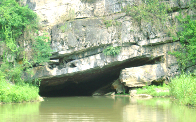
Hua Ma Cave is located in Quang Khe Commune, Ba Be District. The cave has only recently been discovered so it is still almost untouched and enigmatic. The cave has been naturally shaped during the many-thousand-year process of geological changes. It is 700 meters in length and in some places the cave opens up and is 50 meters in height. Inside the cave, there are thousands of stalagmites and stalactites of different shapes; some look like small towers, others are like a statue of Goddess of Mercy or a formal court of mandarins in the feudal time.

In fact, Hua Ma has been known by local people for a long time but, as it bears in a myth and a much-weaved occult story, few local people would dare to approach the gate of the cave. The legend tells that a long time ago, a King headed a raiding contingent visited the locality and when he came to the bank of a stream near the cave, his horse stopped and did not go on. The King got off the horse and asked local people about the reason and local people told him that the area was a habitat of ghosts. According to them, when it was getting dark, cries generated from the cave and they decided that these were the spirits of honest people who were killed by foreign enemies during wars.


The King then ordered his troops to erect a pagoda to pray for peace for the souls of the killed people. Since then, local people have not heard the cries from the cave, yet they still consider the cave a holy place that should not be trespassed upon. As a result, the cave has been hidden until recent times.

If the cave is so mysterious inside, the view outside the cave is also great. From the mouth of the cave, people could see a large space, a vast picture of mountains, forests and water. They could see Ba Be Lake and the Nang River running smoothly in distance, they could hear birds singing elsewhere and imposing mountains and forest in front.

If lucky enough, visitors could participate in a local monthly market to admire girls and boys of several local ethnic minorities in their traditional colourful dresses and clothes. They could taste and become familiar with local typical specialties and they would get drunk with home-made wine and unconsciously fall in love with the place and people.

Both Hua Ma Cave, the local people and the picturesque locality are waiting for international and domestic tourists to explore them.
Source: qdnd.vn

Lotus Flowers in Hanoi

Lotus flowers, although nurtured in mud, have been cherished as a rare species of flower by the Vietnamese people. From time immemorial, they have widely grown nationwide.

Hanoi also has many precious lotus varieties, especially those from the West Lake area. Some parts of lotus flowers are used as medications or to scent tea, making it a tonic drink for a healthy physical and metal life.  To extract lotus essence is really an art and it can be said that nothing is more romantic and purer than "catching" the lotus fragrance.

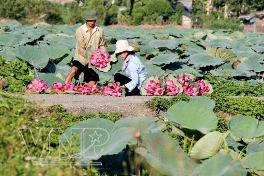
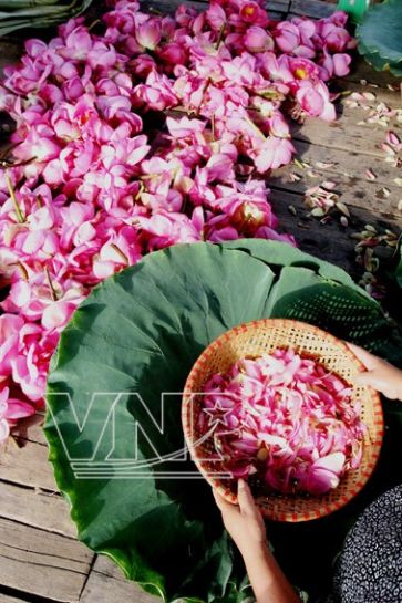
In early morning, when everything is just waking, so pure and anew, it's time to pick lotus flowers from the lake. Over one night sleeping amid the natural environment with cool dews and fresh wind, the fragile petals seem to hold the whole pure essence of the earth. Soon after, the petals are separated, showing the stamen.
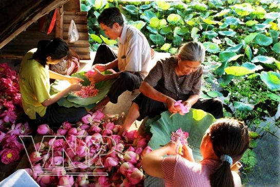
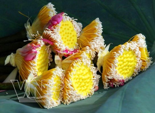
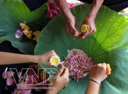
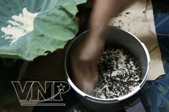
Around the stamen there are bright yellow filements, at the ends of which are little white anthers which provide the special alluring fragrance of this species of flower. Under gentle and skilful hands, the anthers are separated and used to extract a special perfume and scent the tea, turning out a special product, i.e. lotus scented tea. It is hard to find another flower with a fragrance that is more attracting than that of lotus.
  

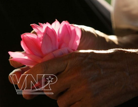
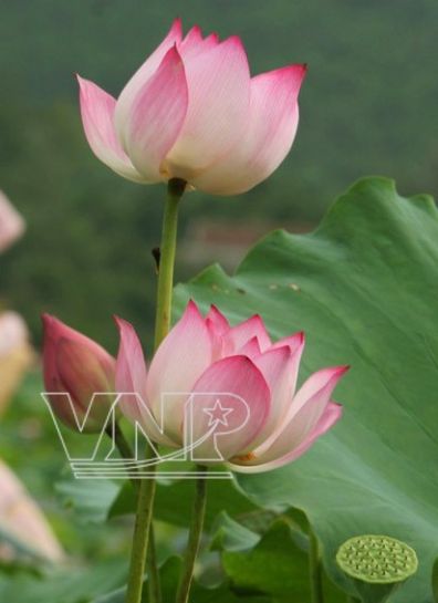
Beautiful and charming lotus petals.

Lotus flowers from the West Lake area in Hanoi are famous for their fragrance.

Getting the anthers to scent tea.

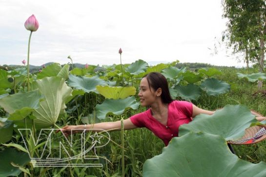
A Hanoi girl in a lotus lake.

Lotus flowers in bloom.

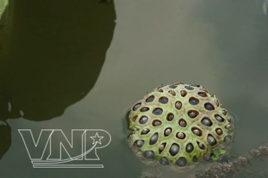
Lotus receptacle. The seeds used to make sweeten porridge are good for health.

Lotus capel.

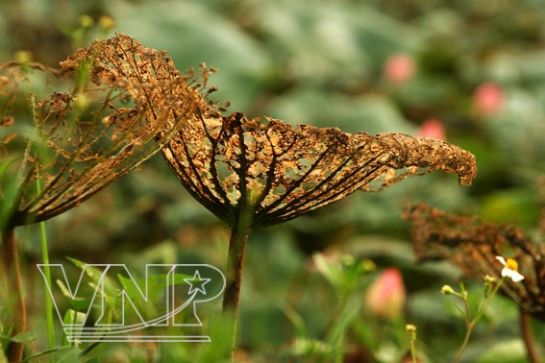
Faded lotus leaves still have unique beauty, like a painting.


Lotus flowers from the West Lake area are special varieties
which grow well and provide fragrance to scent tea.


A lot of secrets about the Vietnamese people's good health and beauty can be related to lotus flowers. In the old days in the royal palaces, the king's beloved concubines were often presented with a lotus bath. After one night, the morning dew that lingered on the lotus leaves was carefully collected as water for the bath. Lotus flowers are not only a luring bouquet, but also have a direct effect to man's nervous system.

Many doctors said that a small cup of tea made from lotus sprouts (green sprouts lying in the centre of the lotus seed) would be a super effective tranquillizer.  It's really hard to fully evaluate the pure beauty of lotus flower, which has become so familiar with many Vietnamese people. Wherever they might go, when seeing lotus flowers, they think of their native homeland and memories about this special flower return to their mind. A symbol of culture, spirit and elegant personality of the Vietnamese, the lotus flower is really worthy of that.
Story: An Na  Photos: An Thanh Hai

Coconut Shoot Salad

Ben Tre Province is known as the capital of coconut trees in South Vietnam. For many years, the coconut tree has been closely attached to the life of local people. Its fruit, leaves, trunk, coconut shells, and coconut fibre, are used to make food and household products.


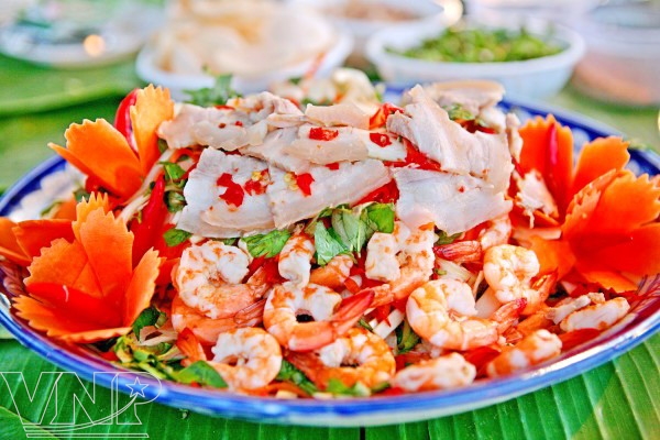
The local people use coconut shoots to create some delicious dishes, such as coconut shoots fried with chicken organs, coconut shoots fried with Xeo cake and coconut shoots salad that is considered the most delicious. The salad is comprised of scraped coconut shoots, peeled shrimps, sliced belly meat, pig’s ears, fragrant knotweed, onion and fried peanuts. It is served with sour and sweet sauce and crispy prawn crackers.


Ingredients (Serves 4):
- Coconut shoots: 300g
- Tiger prawns: 200g
- Belly meat: 100g
- Pig’s ears: 100g
- Carrots: 50g
- Onion: 50g
- Red pepper: 1
- Fried dried onion: 20g
- Fried peanuts: 30g
- 1 teaspoon of lemon juice; fragrant knotweed; fish sauce; and sugar

Preparation:
- Peel shrimps and steam them.
- Boil and slice the belly meat and pig’s ears.
- Scrape coconut shoots and submerge them into cold water mixed with a little of lemon juice.
- Slice carrots, onion and red pepper into threads.
- Mix fish sauce with sugar, lemon juice and red pepper.
- Mix the prepared ingredients with the sauce. Place the salad on a large plate and cover with fried peanuts, fragrant knotweed and fried dried onion.
- Serve with sour and sweet sauce and crispy prawn crackers.
 

Monday, October 29, 2012

Bai Tu Long National Park - Fascinating scenery

Bai Tu Long National Park will bring you amazed feeling and unforgettable experience with enjoying its beautiful scenery, smooth white sands, pure blue water, and biological diversity...

Belonged to the well-known Ha Long Bay – a world cultural heritage, Bai Tu Long National Park will bring you amazed feeling and unforgettable experience!


Be away some 200 kilometers from Hanoi, Bai Tu Long National Park is one of seven Vietnamese amphibian national parks which have both terrestrial zone and aquatic zone. The eco-tourist site is now the home to 672 species of terrestrial plants and 178 aquatic floral species, of which 11 species have been listed in Vietnam’s Red Book of endangered species. 

It also boasts 170 species of terrestrial animals, including nine species listed as endangered in Vietnam’s Red Book; 119 species of fish; 132 species of invertebrate animals; and 106 species of corals.

Natural Condition
Bai Tu Long National Park is a protected area zone in North Vietnam. Established in 2001, surrounded by gigantic rocky limestone mountains, the park covers 15,783 ha, including 6,125 ha of island land and 9,658 ha of tidal land on Ba Mun, Tra Ngo Lon, Tra Ngo Nho, Sau Nam, Sau Dong, Dong Ma, and more than 20 other small islands. 

Apart from its biological diversity, the park boasts wonderful natural landscapes, intact beaches, archaeological sites of ancient Vietnam and vestiges of the former busy trading port of Van Don. Coming to Bai Tu Long every season, you can enjoy very the early beauty of an island with mountain ranges, beaches, stilt house, and sea foods. 

One of the highlighted features of the Bai Tu Long tourist site is the sea eco-tourism community, 60 kilometers from Bai Chay by road or more than one hour by high-speed boat. The National Park also include a buffer zone of approximately 165.34 km2, which locates in a larger area include five communes: Minh Chau, Van Yen, Ban Sen, Quan Lan and Ha Long. The total population of the core zone and the buffer zone is around 24.000.

Ecosystem
The National Park includes five kinds of ecosystems : Rain Broad Leaves Forest, Limestone Forest, Littoral Forest, Coral Area and Shallow Water Area.

The Rain Broad Leaves Forest area is mostly secondary forest. It has been found 494 species belonging to 337 genera of 117 families in this type of ecosystem. Some endangered species include Cycas balansae, Radix marindae officinalis, Ardisia sylvestris Pitard, Smilax glabra, Leopard cat, Indian muntjac, Small Indian civet, Large Indian civet.


The Limestone Forest area is forest growing in poor soil which the particles of limestone on rocky islands. Some rare animal found their include Serow, Rhesus macaque.
The Littoral Ecosystem in the park is small areas surrounding the islands. It has a rather large tidal variation and is biologically highly diverse with 251 species including 19 species of mangrove, 17 species of seaweed , 29 species of marine worms , 149 species of molluscs, 22 species of crustaceans and 15 species of echinoderms.

The Coral area locates from the water depths of low tide to 10m deep. 409 species was found including groupers, sea bass, crabs, snails, abalone and seaweeds.

The Shallow Water area covers a large area around the islands, beyond the tidal area and extend from 1 km to around 4 km. These area was not profoundly researched but it have found 539 species.

What about conservation matter?

To protect the park’s fauna and flora, the local rangers have coordinated with part-time employees to strictly patrol the forest in order to prevent poaching of forestry and sea products. The park’s management board, in coordination with relevant agencies, organised training courses to raise local residents’ awareness about the protection of forestry and maritime resources and inserted environmental protection into the curriculum of local schools. 

The board has also allocated 13 hectares of forests to local households for care and re-forested 50 other hectares on the largest island of Ba Mun. It recently released more than 100 long-tailed monkeys, which were seized from smugglers by the provincial rangers, into forests. Aiming at exploiting the potential and strength of Bai Tu Long, many tourism experts said that Quang Ninh Province needs to encourage investment into building high-end tourist areas that have a suitable scale and harmonious architecture with the environment and the landscape of islands.

Over the past few years, Quang Ninh Province has attached importance to building Bai Tu Long National Park to be an attractive eco-tourism site to both domestic and foreign tourists. Now, it is time to refresh your self by coming to the park and you will be certainly impressed as enjoying its beautiful scenery, smooth white sands, pure blue water, and biological diversity...

Tuan Chau island - A New wonderful island

Tuan Chau island is a new wonderful island with beautiful natural and interesting intertainments, has attracted many domestic and foreigner tourists!

Ha Long, one of the World Heritages, comprises thousands of big and small islands. Each one has its own characteristic with various caves: Sung Sot Cave, Thien Cung Cave, Trinh Nu Cave. 

Tuan Chau Island is the only soil island of all. It is not only a place having beautiful natural surroundings: pine trees, lakes, beautiful beach…but also where President Ho Chi Minh chose to be the relax place of other State officials' and his when they came here in 1959.

Tuan chau island - A Beautiful island

On the total area of 400 ha, Tuan Chau has the population of 1500. As planned, the total area of Tuan Chau will be widen to 675 ha. It enjoys the advantage of having both road and river transportations. It is about 18 km away from National Highway No.1. This route is an important blood vessel of the robust HanoiHai PhongQuang Ninh economic triangle. It takes about 3 hours from Mong Cai ( 2 hours by boat) and 1 hour from Hai Phong. 


Tuan Chau island’s name is the combination between ‘linh tuan’ (the patrolman) and ‘tri chau’ (district chief) because in the feudal time, the royal army set up a guard station here to patrol and defend the borderland. 

Prior to 1999, the island's residents suffered from a very modest living standard.There was no power network and no clean water. Roads were only trails and there was no mechanical means of transportation. Tuan Chau was a very poor town where fishing with very rudimentary tools is the only means of living.

The first project of great significance was to link Tuan Chau and the National Highway No18 by building a road. The work was officially started on February 28th, 1998. All company staff had to overcome numerous hardships to achieve this difficult task, which translated people’s dream into reality. 
        
Dolphin & Seal Club

Tuan Chau has become well- known to both international and domestic tourists as an attractive destination with:
- a dolphin&seal club
- a circus
- a crocodile club
- an (artificial) beach with 4 km long.
- a Vietnamese culinary area
- a hotel and resort area of 5-star standard (200 rooms)
- a water recreation park with activities such as motor racing, canoeing, parachuting, water skiing, etc.
- Ha Long Bay sight- seeing services by canoe, boat, helicopter.
- a high tech water fountain with music playing, laser lighting and film projecting on water screens.

Sunday, October 28, 2012

Cat Ba island and beaches


Cat Ba is the largest of the 366 islands spanning 260km2 that comprise the Cat Ba Archipelago, which makes up the southeastern edge of Ha Long Bay in Northern Vietnam. Cat Ba island has a surface area of 285 km2 and maintains the dramatic and rugged features of Ha Long Bay. It is commonly used as an overnight hotel stop on tours to Ha Long Bay run by travel agents from Hanoi.

Over view of Cat Ba island:

Cat Ba is the largest island in the Bay and approximately half of its area is covered by a National Park, which is home to the highly endangered Cat Ba Langur. The island has a wide variety of natural ecosystems, both marine and terrestrial, leading to incredibly high rates of biodiversity. Types of natural habitats found on Cat Ba Archipelago include limestone karsts, tropical limestone forests, coral reefs, mangrove and sea grass beds, lagoons, beaches, caves, and willow swamp forests. 

Cat Ba Island is one of the only populated islands in Ha Long Bay, with roughly 13,000 inhabitants living in six different communes, and 4,000 more inhabitants living on floating fishing villages off the coast. The large majority of the population can be found in Cat Ba Town which is located at the southern tip of the Island (15 km south of the national park) and is the commercial center on the Island. Since 1997, Cat Ba Town has grown rapidly and has become a tourist hub for both the Island and greater Ha Long Bay.


History of Cat Ba Island:

Archeological evidence suggests that people have lived on Cat Ba Island for almost 6,000 years, with the earliest settlements being found on the southeastern tip of the Island close to the area where Ban Beo harbor sits today. In 1938, a group of French archeologists discovered human remains belonging "to the Cai Beo people of the Ha Long culture, which lived between 4,000 and 6,500 years ago… considered to be perhaps the first population group occupying the North-Eastern territorial waters of Vietnam… the Cai Beo people may be an intermediary link between the population strata at the end of the Neolithic Age, some 4,000 years ago". 

In more recent history, Cat Ba Island was inhabited mostly by Viet-Chinese fisherman and was largely influenced by both the French and American wars. The Island was a strategic look-out point and bombing during the wars often forced local residents to hide among the Island's many caves. Today, the best reminders of the two wars have been turned into tourist attractions. 

Hospital Cave, which was a secret, bomb-proof hospital during the American War and as a safe house for VC leaders. This three-story feat of engineering was in use until 1975 is only 10 km north of Cat Ba Town. The second attraction, the newly built Cannon Fort, sits on a peak 177 meters high, offering visitors a chance to see old bunkers and helicopter landing stations as well stunning views Cat Ba Island, its coast, and the limestone karsts in Lan Ha Bay offshore.

Cat Ba national park:
At the heart of Cat Ba Island lies a visually stunning and ecologically diverse national park. In 1986, 9,800 [98 km²] hectares (approximately one third of the Island's total land mass) was annexed as Cat Ba National Park, the first decreed protected area in Vietnam to include a marine component (Dawkins 14). It had previously been the site of a timber company. 

In 2006, the boundaries of the national park were redefined, so the park contained 109 km² of land area and an additional 52 km² of inshore waters and mangrove covered tidal zones (langur website). The park is staffed by 92 people, including over 60 park rangers. In 2004, Cat Ba Archipelago was declared a UNESCO Man and Biosphere Reserve Area in order to protect the multiple terrestrial and aquatic ecosystems as well the diverse plant and animal life that is found on the Island. The UNESCO designation divides the archipelago into three distinct areas, each with certain functions and restrictions that regulates development and conservation measures on the Island.

Cat Ba national park

Cat Co Beach, Cat Ba Island
The white-sand Cat Co beaches (simply called Cat Co 1 and Cat Co 2) make a great place to lounge around for the day. They are about 1 km southeast from Cat Ba town over a steep headland; and can be reached on foot or by motorbike or taxi. The two beaches are separated by a small hillock that can be climbed over in about 20 minutes. Most; however; take the easier route along a new; 700m; wooden seaside walkway around the mountain. Cat Co 2 is the less busy and more attractive of the two; and also offers simple accommodation and camping. On weekends the beaches fill up with Vietnamese tourists. The main beaches; apart from those at Cat Ba town itself; are Cai Vieng; Hong Xoai Be and Hong Xoai Lon.

Monkey Island ( Cat Dua island)

Monkey Island beach

Monkey Island stay in the area of Nam Cat, Lan Ha bay. There are 5 sandy beach here and Monkey Island beach is the most beautiful and the biggest one. From Cat Ba town, you have to take a taxi or motobike to Beo harbour where you go by boat to Monkey Island. It takes you about 15 minutes, throught the floating village and many beautiful islets with sea birds flying in group up and down.

In the past, this island was called Cat Dua island ( Pine Apple Sand Beach island) because there is a lot of pine apple trees on the sandy beach. In recent years, there are many tourists come and they found many monkeys on the island then this is called Monkey Island beside the name Cat Dua.

Monkey island is about 5 km round with the front side are 2 sandy beaches and the back side is like rocky mountain. The beaches here are very beautiful with pine apple trees on the beach and many kind of green trees on the mountain.

There are about 20 monkeys on the island. They live on the mountain, in the garden and some time go to the beach for foods given by the tourist. Coming here, you also can enjoy the song of the birds in the garden or see many fishes swimming in the clean water.

Monkey Island is an ideal place for tourist holiday with many activities like play football, volley ball on beach, swimming, snockeling or go fishing. Especially, you can do kayaking around as the water here is calm like in a lake with hundreds of islets around.

Cat Ba tourism:

Cat Ba Island has become the adventure-tourism capital of Vietnam, and many of the activities advertised are nature-based. Visitors can kayak and take boat cruises through Ha Long Bay and the Cat Ba Archipelago, hike through the national park, mountain bike around the Island, spend time on Monkey Island just offshore, explore the Island's many caves, swim on Cat Co 1, 2, or 3 (three sandy beaches a short walk from Cat Ba Town), or even rock climb on the limestone karsts. 

With its stunning scenery, its association with Ha Long Bay, its proximity to highly populous cities like Haiphong (50 km) and Hanoi (150 km), and even China (many regional visitors come to the Island in the summer, the busy season, to avoid the heat and pollution in the cities), and plenty to do, Cat Ba Island has become a major travel destination for foreign and Vietnamese visitors alike.

Cat Co beach in Cat Ba island in summer
The People

Cat Ba Island is currently inhabited by almost 12000 people, living in 6 communes - of which Cat Ba Town with 7820 people is the largest.
The area has two ethnic groups, namely the Kinh and the Chinese-born Vietnamese that are intermingled and not separated into different areas or communities. Based on archaeological remains, it seems that people have inhabited the Cat Ba area for at least 6000 years.
Local livelihoods in the villages are built on subsistence agriculture and fishing. Comparatively new sources of employment and income at the local level are shrimp and fish-farming, and tourism.

Friday, October 26, 2012

Pu Sam Cap Grottoes in Lai Chau

The Pu Sam Cap Grottoes in Lai Chau province, named after the nearby village or the homonymous mountain, ar noted for fine speleothems. This very young show cave which attracts many domestic tourists as well as foreign tourists in Vietnam travel to come here and visit.

The cave is located high up on the 1,700m asl high Pu Sam Cap Mountain. It is reached from the parking lot on a short but strenuous walk uphill, which is rewarded by the extraordinary views of the valley and Nam Ron River, and the beautiful cave.


Travel Attraction: Pu Sam Cap Grottoes In Lai Chau

Luckily, the road that winds alongside the valley and up the mountain offers terrific views. Though the chill grows stronger as one nears the destination, the climb up the mountain to the grotto’s entrance leaves one considerably warmer.

Upon arrival, visitors can cast their eyes back over the valley. The whole village is often obscured by clouds, though shafts of sunlight pierce through, leaving bright spots on the overcast landscape. Below, the waters of Nam Ron River are barely visible as they snake their way through the mountains.

For tourists in Vietnam travel, touring the entire grotto takes at least one day if they are feeling strong enough to undertake the two-way climb. The area contains over 10 caves of varying sizes which all converge around the three largest: Thien Mon, Thien Duong and Thuy Tinh.

Given a limited time frame, guides advise visiting the lowest cave, Thien Mon, as it is the easiest climb, instead of trying to reach all three.

Their advice is well-heeded. Standing among the stalactites in Thien Mon, stress and weariness melt away and imaginations wander over the shapes of the stalactites. In the front, one resembles an elephant statue, another, a group of fairies dancing.

While Pu Sam Cap is not very different from other grottoes in terms of position, beauty or size, what sets it apart is its simplicity and isolation.

It allows so much privacy that in addition to guiding visitors through Pu Sam Cap. In the middle of the cave there is a large, flat area where they play football.

Six months after the discovery of the caves, more than 10,000 tourists have visited Pu Sam Cap, and the number is increasing year by year. Yet the simplicity of the services is posing problems for the area’s reputation.

Small steps have been added to each cave to prevent tourists from getting lost and lights have been suitably arranged throughout.

With much effort, Pu Sam Cap Grottoes will be more and more attractive for tourists in Vietnam travel, one of Vietnam attractions for tourism.

Sin Ho town - "the second Sapa” of the northwest

Flying far from the well-known and colourful markets of Sapa, Bac Ha and Can Cau, is the bewitching northwest mountainous area of Vietnam with the remote town and market of Sin Ho, the roof of Lai Chau province. 

Sin Ho town is located on the highest peak of the Sin Ho plateau in Lai Chau province, over 2,000m above sea level, and surrounded by verdant mountain ranges and clouds. In Vietnam tourism, tourists come here and feel that Sin Ho town looks like “ the second Sapa” of Lai Chau province. But the climate in Sin Ho is even dourer and more fickle than that of Sapa. One minute, you can be standing in a sea of white clouds, then several minutes later, the rain will pour down like a waterfall. But as soon as the last raindrop falls, the sun will rise again brilliantly and a cool breeze will blow over the small town.


It takes four hours to drive up the zigzagging road from Phong Tho, at the junction between national Road No.4D from Sapa and National Road No.12 towards Muong Lay. The mountain road has been smoothly paved, but it’s still a slow and winding drive.

In the late afternoon, Sin Ho looks small, deserted and gloomy, with sparse simple wooden houses roofed with dark grey cement tiles and only a few shops and restaurants. Fortunately there are several modern guesthouses and mini hotels at a reasonable price, only VND250,000 per twin room. 

On Sunday morning, the sleepy town comes alive. Waves of ethnic people walk or ride horses and motorbikes on all the roads and paths leading to the town centre, loaded up with many kinds of farm products, heading towards the market. These ethnic minority people come from many distant villages up and down the mountains. They are members of the Flower Hmong, Blue Hmong, Black Hmong, Lu, Black Dao and Red Dao minorities and others.

                  
Pha Xo Lin II village, just three kilometers from the town centre, is home to the Dao Khau tribe, also known as the Sewing Dao or Black Dao, who wear black trousers richly embroidered with the signature flower, tree and star patterns that can be seen on many Dao costumes. They also wear a black apron in front, with a wide, plain blue border and a plain black turban.

The village is very beautiful and poetic, with dark wooden houses roofed with black stone tiles and fenced in with stone walls. This is the season the peach and mango orchards are ripening in a riot of red and yellow. It’s delicious to walk in the village, where you can take a seat  under the fruit trees to enjoy lovely lanterns swinging in the cool breezes, as well as their fresh and sweet tastes.

Pha Xo Lin is very famous for its special golden red mangoes, with their sweet, jackfruit-like flavour.
Besides its delicious fruit, Pha Xo Lin is a shopping paradise for brocades and embroidered products. It’s common to see Dao women sitting on their thresholds in their front yards or under the fruit trees sewing passionately. Their products are very sophisticated and beautiful, as befitting of their name- the Sewing Dao tribe.
  Source: Timeout

Wednesday, October 24, 2012

Hue Temple of Literature - A unique symbol of Vietnam’s past educational system

If the Temple of Literature in Hanoi is known as the first university in Vietnam and aslo called Van Mieu Quoc Tu Giam in Vietnamese language, Hue Temple of Literature is regarded as a worship temple founded by the Nguyen Dynasty to dedicate to celebrated scholars of Confucianism.

During the old time, various Temples of Literature were built by the Nguyen Lords in the capital and moved to three different places: Trieu Son Village, Luong Quang Village and Long Ho Village. Hue Temple of Literature , also called Van Mieu Hue in Vietnamese language, is a worship temple founded by the Nguyen Dynasty to dedicate to celebrated scholars of Confucianism.

Hue Temple of Literature
In 1808, Gia Long and his Imperial Court decided to choose a low hill beyond the Thien Mu Pagoda, on the left bank of the Perfume River, i.e. the current position, to built a new imposing and striking Temple of Literature. The construction of the Temple of Literature was commenced on April 17th, 1808 and finished on November 12th, 1808.

The Temple of Literature faces south. All main constructive works were built on the top of the hill, three meters higher than the surrounding land. In front of it was the Perfume River, in the back was villages, hills and mounts spreading from Truong Son Range. 

All items of Hue Temple of Literature were erected on a square surface of 160m long on each side enclosed by La Thanh (surrounding wall). There was once a complex of 50 big and small constructions including 32 steles which bore names of doctors and four other steles.

Hue Temple of Literature

The Temple of Literature was many times renovated and many sub - constructions were built, especially in Minh Mang and Thieu Tri's time. From Minh Mang's time onwards, National Examinations were held so that steles bearing the names of successful candidates were erected here. These "Tien si de danh bia" - "Steles bearing doctors' names" were gradually erected on the yard of the main temple from 1831 to 1919, the year in which the last National Examinations was held in Khai Dinh's time.

Hue Temple of literature
"Steles bearing doctors' names" in Hue Temple of Literature

As destroyed by the war and weather, the remains of the Temple of Literature are now the 34 steles of great cultural and historic value. On these steles are names, ages and places of birth of 239 successful candidates in National Examinations organized in the Nguyen Dynasty.

Today, visiting Hue Temple of Literature, tourists can see the unique symbol of Vietnam’s past eductional system. They can understand more about the tradition of knowledge appreciation, scholars administration and study encouragement of our ancestors during the feudal times.